Exploring Almost Forgotten Gravesites in the Great State of Ohio

Dedicated to cemetery preservation in the great state of Ohio


"A cemetery may be considered as abandoned when all or practically all of the bodies have been Removed therefrom and no bodies have been buried therein for a great many years, and the cemetery has been so long neglected as entirely to lose its identity as such, and is no longer known, recognized and respected by the public as a cemetery. 1953 OAG 2978."

Friday, May 30, 2025

Lucas County, Ohio G.I.S. Cemeteries Maps Updates from Brian S. Miller - the Records/IT/CAD Manager for the Lucas County Engineer's Office.

 Updates to the Lucas County, Ohio Engineer's Cemeteries website.  Please see remarks by Brian S. Miller.: 

Main G.I.S. Map Gallery for Lucas County, Ohio.

https://experience.arcgis.com/experience/c124b6564e1640d78040c39c39c155cd/
~*~*~*~*~*~*~*~*~*~
Lucas County, Ohio main cemeteries maps.:

https://experience.arcgis.com/experience/b5e85dd2286446cdae5cc3d79becf863/page/Page

~*~*~*~*~*~*~*~*~*~

Lucas County Ohio Cemeteries - Lucas County Ohio Engineer's Cemetery maps of cemeteries that no longer exist. (Polish National Cemetery - Example.)

~*~*~*~*~*~*~*~*~*~

From Brian S. Miller:

"I have added some new features to the Engineer’s Cemetery Map.":


  1. In the upper right-hand corner of the screen, you will now see a GPS coordinates tool that reads the GPS coordinates on the fly as you move your mouse. You can also capture GPS coordinates of any location on the map by clicking the cursor icon button on the left side of the GPS tool, select the location on the map and your desired coordinates are saved to the GPS tool window. Once captured, you can then click the copy to clipboard button on the right side of the GPS tool. Now you can paste those coordinates to any desired application you need it for.
  2. In the row of tools at the bottom, I have added the Share Tool icon, which allows you to copy and share a link to anyone of the map at the location you are zoomed into.
  3. In the lower right-hand corner of the screen, I have added the Measurement tool, which can come in quite handy if you need to measure something on the map. It will measure in many different units. Measuring distances is in feet by default. Measuring an area is in square feet by default.


"These 3 new features can be quite handy in certain circumstances." 


~*~*~*~*~*~*~*~*~*~
~*~*~*~*~*~*~*~*~*~

Wednesday, May 28, 2025

From the "Record Herald" - "Explore Fayette County's Past in Bloomingburg Cemetery Tour" - Monday - June 16 2025 - 6:30pm with Mr. Paul LaRue


Mr. Paul LaRue left.:

**************
"BLOOMINGBURG, Ohio — Historian and educator Paul LaRue will lead a program called “A Walk in the Bloomingburg Cemetery” on Monday, June 16, 2025, at 6:30 p.m., giving a tour of prominent gravesites from Fayette County. The Bloomingburg Cemetery is located on State Route 38 in Bloomingburg."

"The “cemetery walk” is open to the public. LaRue’s tours provide history and genealogical facts about prominent people of Fayette County, and this tour will focus on Bloomingburg.

A former history teacher and researcher, LaRue’s tours are educational and informative. He thanked the Bloomingburg Cemetery Board “for allowing this tour to take place.”

The Fayette County Genealogical Society is sponsoring the tour. All are welcome to attend and learn from history, LaRue said."

~*~*~*~*~*~*~*~*~
The Bloomingburg Cemetery on Find a Grave.

Sunday, May 25, 2025

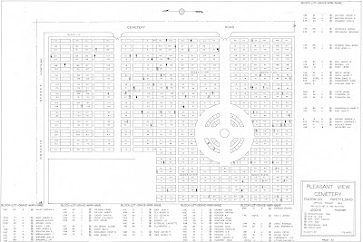
The Fulton County W.P.A. Cemetery Plat Maps have been added to the right sidebar of the blog

The Fulton County, Ohio W.P.A. Cemetery Plat Maps have been added to the right sidebar of the blog.  

Thanking Elizabeth Blakely-White, GIS Assistant - Fulton County Auditor for sharing the .pdf images of these pristine condition cemetery plat maps.  Scott Yoder is the Director of the G.I.S. Department of the Fulton County Auditor. 

Sharing the Fulton County, Ohio Grave G.I.S. Database.:
~*~*~*~*~*~*~*~*~*~*~
The Pleasant View Cemetery (AKA Pleasant View Union Cemetery) has a Soldiers' Circle. 

Sharing from the Description provided for this cemetery as listed for it on Find a Grave.:
"The Pleasant View Cemetery is located west of Maple Street and south of Ontario Street in the southwest section of the village of Fayette. The older section of Pleasant View Cemetery was a family burial ground on land owned by John Gamber. By 1852 the site had been expanded to serve the local area. The first burial is difficult to determine as grave markers were moved to Pleasant View from abandoned cemeteries. The first burial may have been as early as 1836."

~*~*~*~*~*~*~*~*~*~*~

The Fluhart Cemetery in York Township

Jacob Lozier was an American Revolutionary War veteran.: 

~*~*~*~*~*~*~*~*~*~*~
Phineas Brown - American Revolutionary War veteran who was buried at the Jordan (AKA Edgar) Cemetery

~*~*~*~*~*~*~*~*~*~*~
The Fulton County W.P.A. Cemetery Plat Maps collection is one that has been wonderfully preserved over many decades and is now available for public research; thus ensuring that this valuable information will not be lost!