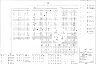
The Fulton County, Ohio W.P.A. Cemetery Plat Maps have been added to the right sidebar of the blog.
Thanking Elizabeth Blakely-White, GIS Assistant - Fulton County Auditor for sharing the .pdf images of these pristine condition cemetery plat maps. Scott Yoder is the Director of the G.I.S. Department of the Fulton County Auditor.
Sharing the Fulton County, Ohio Grave G.I.S. Database.:
~*~*~*~*~*~*~*~*~*~*~
The Pleasant View Cemetery (AKA Pleasant View Union Cemetery) has a Soldiers' Circle.

Sharing from the Description provided for this cemetery as listed for it on Find a Grave.:
"The Pleasant View Cemetery is located west of Maple Street and south of Ontario Street in the southwest section of the village of Fayette. The older section of Pleasant View Cemetery was a family burial ground on land owned by John Gamber. By 1852 the site had been expanded to serve the local area. The first burial is difficult to determine as grave markers were moved to Pleasant View from abandoned cemeteries. The first burial may have been as early as 1836."
~*~*~*~*~*~*~*~*~*~*~
~*~*~*~*~*~*~*~*~*~*~
The Fulton County W.P.A. Cemetery Plat Maps collection is one that has been wonderfully preserved over many decades and is now available for public research; thus ensuring that this valuable information will not be lost!


%20CEM%20-%20VETS%20NAMES%20-%20PAGE%20116.jpg)